|

BOAT/MOTOR
SALES/SERVICE
Statesboro, GA

FISHING CHARTERS
Savannah, GA


INFORMATION SITES

3D Views of the South Ledge Area
This image is a close-up of a NOAA Bathymetric Chart showing the South Ledge area.
The largest of the three humps visible below the South Ledge (1a) creates the largest
upwelling in this area. The horseshoe
shaped hump outside 79 55W between the South Ledge and the three humps
(2) creates another large
upwelling.
(Left click on image to view full screen.)
1a - 3105.932 7955.633
1b - 3105.920 7955.121
2 - 3107.163 7954.118
|

|
This image is a shaded bathymetric contour of the South Ledge area created using HotSpots Charts, LLC 3D software. Dark red
represents the shallowest depths, dark blue the deepest. The two
upwelling areas mentioned above can be clearly
seen here as red spots.
(Left click on image to view full screen.)
|

|
This image is a rate-of-change in depth shaded contour of the South Ledge area created using HotSpots Charts, LLC 3D software.
Areas with rapid increases in depth (moving left to right) are red, while areas with rapid decreases in depth are blue.
The two upwelling areas mentioned above can be seen here as spots that are red on their inshore side, blue on their
offshore side. Lighter blue spots on this chart show the locations of smaller ledges along the 30-fathom curve.
(Left click on image to view full screen.)
|

|
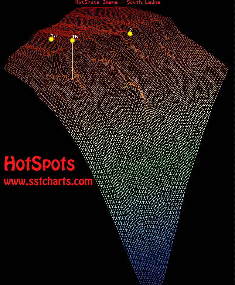
This image is a three-dimensional wireframe image of the South Ledge area created using HotSpots Charts, LLC 3D software. Depth is
shown by wireframe color here as it is in the shaded bathymetric contour chart above. The two
upwelling areas mentioned
above can be seen here as points in the lower section of the image.
(Left click on image to view full screen.)
|
|
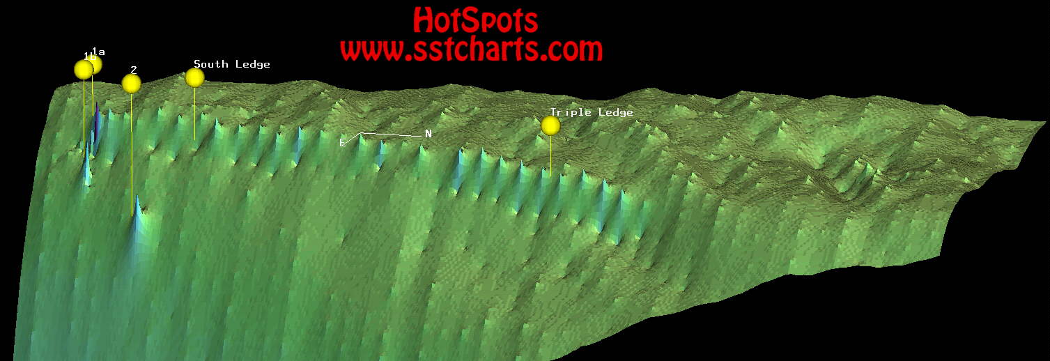
This image is a three-dimensional shaded rate-of-change in depth image of the South Ledge area created using HotSpots Charts, LLC 3D software.
Those areas shown in dark blue have the steepest drop-offs. This image shows that the edge of the continental shelf between the Triple Ledge and South Ledge
has a steeper grade than the edge of the shelf north and south of this area. This indicates that this area is more likely to create productive upwellings for fishing
than the surrounding areas.
|
|
|


 E-Mail HotSpots Charts, LLC